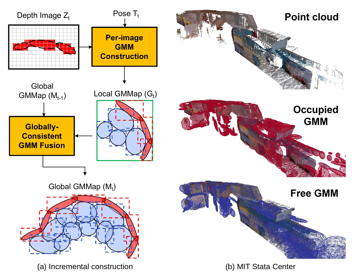
A compact map must also be efficient to construct
A robot needs to distinguish obstacles, observed free space, and regions its sensors have not explored. An occupancy map records these states so the robot can check possible paths and identify places to explore.
A compact map can still require repeated processing of raw measurements as new observations arrive. Storing and moving those intermediate data can dominate memory use during construction. My doctoral research therefore considered the representation and its construction pipeline together.
Occupancy maps and sensor observations
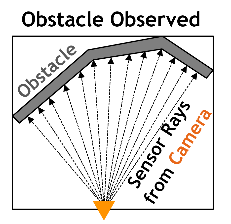
A depth camera measures distances to surfaces along viewing directions, illustrated here as sensor rays in a simplified two-dimensional scene.
Select a figure to enlarge it.
Sensor rays
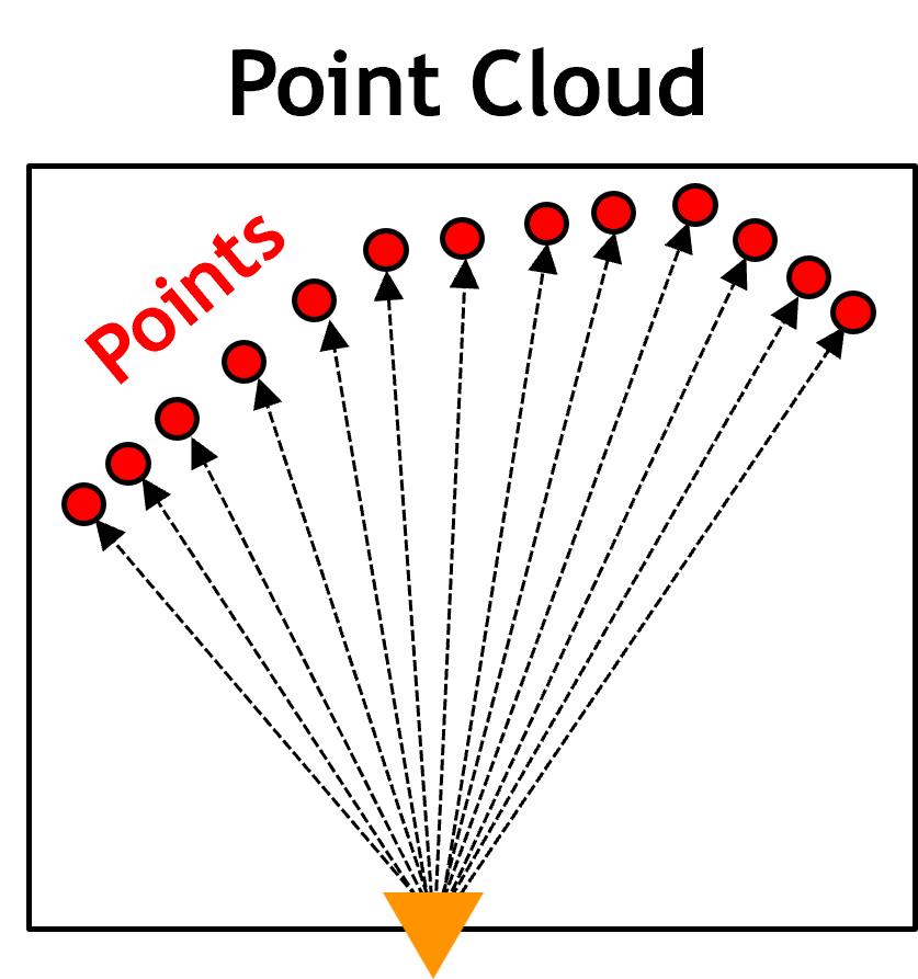
Point cloud
Occupancy map
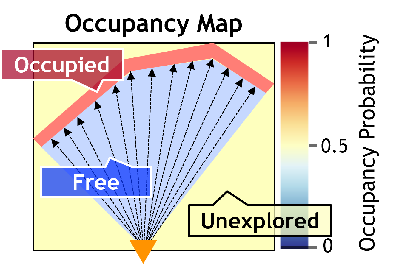
This distinction supports collision checking without assuming that an unobserved region is safe for the robot to traverse.
From voxels to Gaussians
Voxel maps divide space into cubes, while GMMap uses Gaussian distributions whose size and orientation adapt to observed geometry. The example below shows how one Gaussian can summarize multiple voxels covering the same region.
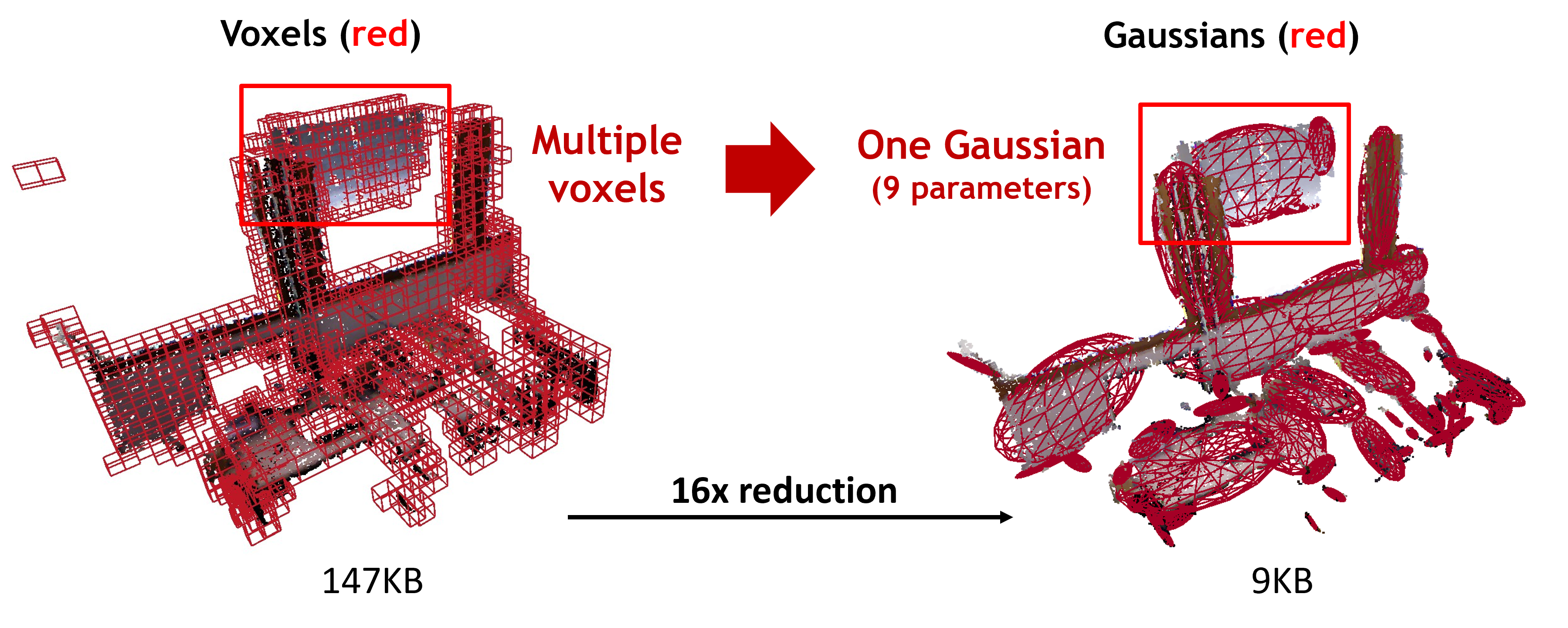
Figures: Fu, Li, Karaman, and Sze, Gleanmer project, MIT LEAN.
Representing occupied, free, and unexplored space
GMMap is a continuous occupancy map based on a Gaussian mixture model. It was published in IEEE Transactions on Robotics in 2024. The paper evaluates both the quality of the map and the resources needed to construct and query it.
In GMMap, Gaussians adapt their size, orientation, and placement to the observed geometry. Occupied Gaussians describe surfaces and obstacles, while free Gaussians describe observed obstacle-free regions. The representation is continuous: occupancy can be queried at a spatial coordinate without first converting the map to a uniform voxel grid.
Navigation also requires distinguishing unexplored regions from observed free space. The absence of an obstacle measurement is insufficient evidence that a region is safe. GMMap therefore incorporates an unexplored prior into Gaussian mixture regression, preserving the distinction between unknown and observed free regions. Its parameters also control the extent of spatial interpolation near the boundary of explored space.
Constructing the map without repeatedly expanding the data
The construction pipeline begins with a depth image. Single-pass Gaussian fitting groups adjacent measurements into compact local Gaussians. New observations are fused with the existing map directly in this representation, rather than expanded into point clouds and repeatedly processed along every sensor ray.
This representation–algorithm co-design jointly selects the geometric primitive and the operations that construct and query it. Compact intermediate representations reduce the data retained and moved between operations. A spatial index identifies the Gaussians relevant to an update or a query, supporting localized computation.
I developed GMMap and SPGF under the guidance of my advisers, Vivienne Sze and Sertac Karaman. SPGF, published at ICRA 2022, provides memory-efficient Gaussian fitting from depth images. GMMap extends that construction approach into a persistent occupancy map with direct fusion and occupancy queries. These operations later provided the workload for the Gleanmer chip.
Visual comparisons with prior maps
The comparisons below show how GMMap’s adaptable Gaussians represent geometry in the structured indoor Room environment and the unstructured outdoor Gascola environment.
Red marks occupied estimates overlaid on the reference geometry; free space is omitted. The first two panels show the same continuous GMMap, as Gaussian ellipsoids and as sampled voxels.
Gaussians are continuous and unbounded: their distributions extend beyond the ellipsoids drawn for visualization. These wireframes show selected contours, rather than the limits of occupied space. The inferred obstacle surfaces can therefore extend beyond them, as the paired Gaussian and voxel views illustrate.
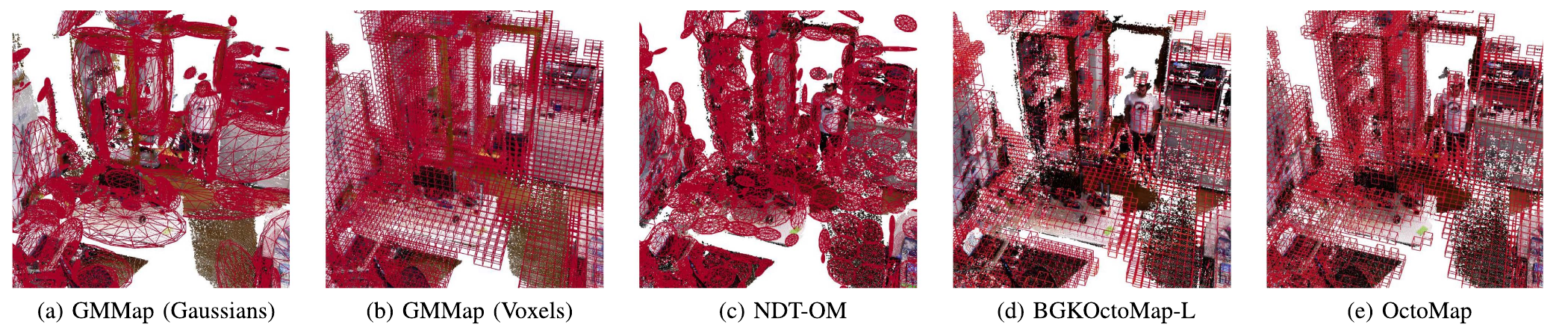
In Room, GMMap’s Gaussians adapt to the orientation and thickness of surfaces, reducing the cubic artifacts visible in the voxel-based maps. This flexibility supports the combination of geometric fidelity and compact storage reported in the evaluation.
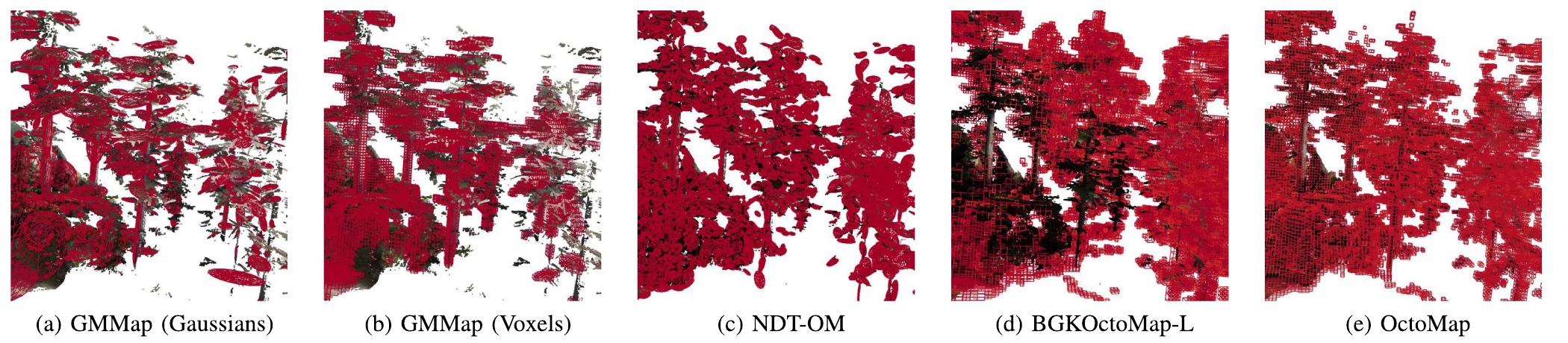
In Gascola, compactness comes at the cost of some distant detail, including small leaves. Occupancy accuracy remains comparable but slightly below OctoMap’s in this scene. Retaining more detail increases map size; omitted regions remain unexplored rather than being labeled free.
Evaluating quality, memory, throughput, and energy
Across the evaluated indoor and outdoor environments, GMMap achieves accuracy comparable to the prior frameworks with a more compact representation. Map size decreases by at least 56%, construction memory overhead by at least 88%, DRAM access by at least 78%, and energy by at least 69%.
The CPU implementation reaches up to 60 depth images per second on an ARM Cortex-A57 platform. The public repository provides the software; Gleanmer’s project page reports its subsequent silicon implementation.
Watch the GMMap research presentation.
Cite this work
GMMap: Memory-Efficient Continuous Occupancy Map Using Gaussian Mixture Model
BibTeX
@article{li2024gmmap,
  author = {Li, Peter Zhi Xuan and Karaman, Sertac and Sze, Vivienne},
  title = {{GMMap}: Memory-Efficient Continuous Occupancy Map Using Gaussian Mixture Model},
  journal = {IEEE Transactions on Robotics},
  volume = {40}, pages = {1339--1355},
  year = {2024},
  doi = {10.1109/TRO.2023.3348305}
}Related research